Twin Otter Garmin G950 NXi Integrated Flight Deck System
All-Glass, All Powerful
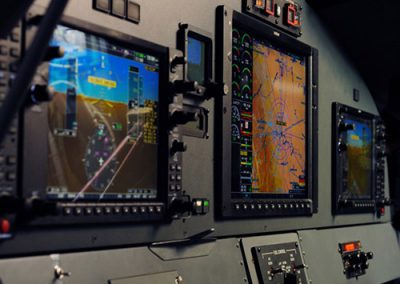
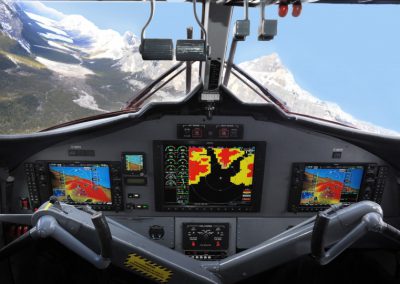
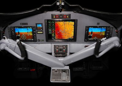
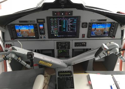
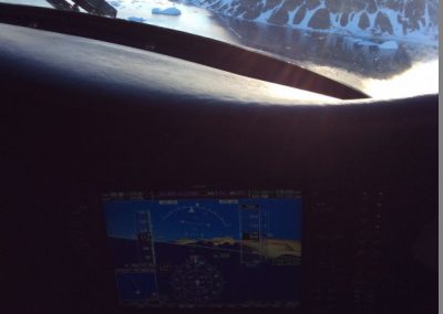
Multi-Function Display (MFD) and flanked by Primary Flight Displays (PFDs) at the captain and first-officer positions. Each PFD clearly depicts aircraft attitude, airspeed, climb rate, altimeter and horizontal course/heading information. And with optional SVT™ synthetic vision technology, your crew can now fly with a realistic 3-D view of topographic features surrounding their aircraft, adding a whole new level of safety. Using sophisticated graphics modeling, Garmin SVT tracks the navigation system’s terrain alerting database to recreate this “virtual reality” landscape that looks so real and life like, it’s almost like having a clear-day “out-the-window” view – even in solid IFR or nighttime VFR conditions. Plus, SVT offers a flight path vector that predicts your aircraft’s direction to simplify precision flying.
In the center of the panel, you’ll find essential engine and fuel systems data on the G950’s MFD – along with detailed moving-map graphics showing the aircraft’s current position in relation to ground features, chart data, navaids, flight plan routings, and more. Preloaded Garmin FliteCharts® and SafeTaxi® databases come standard with the package (Jeppesen Charts powered by Garmin ChartView™ is optional) to provide electronic versions of AeroNav, Eurocontrol and Nav Canada terminal procedures and approach plates for the U.S., Europe and Canada. And SafeTaxi makes ground ops seamless by displaying the aircraft’s exact location on the airport. Plus, the G950’s MFD map display interfaces with a growing array of remote sensors and tracking systems, making it simple for your crews to selectively overlay graphical weather, lightning, traffic, terrain and other avoidance system advisories. Class B TAWS terrain alerting, with worldwide terrain and U.S. obstacles database comes standard with Class A TAWS as an option. SiriusXM™ weather can be added as an option (subscription required). With the SXM link, NEXRAD weather, METARs, TAFs, TFRs, winds aloft, echo tops, surface precipitation, lightning strikes, storm cell data, and more can be received, regardless of altitude. Add worldwide weather via the Iridium network with an optional satellite datalink, and get tactical weather analysis with an optional digital color radar; this fully stabilized full-color radar features pilot-adjustable horizontal scans up to 120 degrees, as well as useful vertical scanning mode to help analyze storm tops, gradients and cell-buildup activity at various altitudes.
NextGen Twin Otter
Low Maintenance Cost
Saving Weight – and Wait
Based on the groundbreaking G1000 integrated flight deck, the G950 can bring even more value, utility, and service life to your Twin Otter cockpit systems. And it can do so while improving situational awareness and efficiency. No other upgrade comes close to the benefits of the G950 – for anything close to the price.
All of these capabilities can often be installed on your aircraft during an already-scheduled maintenance inspection – even though the G950 retrofit package replaces most existing avionics equipment and wiring. Aerocorp Avionic Solutions Inc is a Transport Canada and EASA Approved Maintenance Organization with Manufacturer Approval that specializes in the design, fabrication, kitting, installation, modification, and repair of complex aircraft electrical harnesses and avionics systems. Aerocorp Avionic Solution Inc’s experience in commercial, business and general aviation aircraft, its repair station operations specifications allow the company to install and repair avionics systems in most fixed or rotary-wing aircraft at the Calgary International Airport or offsite with no geographical limitation utilizing mobile modification teams. So when it’s time to upgrade your Twin Otter fleet for the future, there’s no other solution that adds all the capabilities of an integrated flight deck with the tangible cost benefits of the Garmin G950 upgrade. It’s not just a retrofit. It’s fit for the future.
(403) 717-9730
– or –

